While most people are acclimatised to it, roadside infrastructure is vital to the safety of transport. From damaged signage to curb drains, the ‘health’ of these ubiquitous assets can have a massive impact on the efficiency of the road networks.
Yet, until now, the technology to effectively track the impact of degradation or damage to roadside infrastructure hasn’t been available to the organisations responsible for installing and maintaining these features, such as local authorities and utilities companies. Absence of such technology, in addition to limiting the management of roadside assets, means that indicators of potential issues with roads and neighbouring utilities could go unnoticed, until an event such as a burst pipe becomes severe enough to draw attention.
Lack of visibility
The cost of maintaining and repairing this damage is also immense—in England, for example, 2019 saw the average highway maintenance budget per local authority rise to £31.5m (US$40.9m) a year. Further costs to the economy are incurred by the delays these road works and repairs cause to transport networks, preventing drivers from commuting, carrying out deliveries, and increasing the likelihood of accidents through increased driver frustration and tailgating by cars.
As well as posing a risk to the average road user, lack of visibility of roadside infrastructure could be a major threat to the successful roll-out of transport innovations such as electric vehicles (EVs). In order to meet global and national targets for phasing-out gasoline and diesel cars, there is an urgent need to upgrade the power grids to support new electricity demand from e-mobility.

Awareness of the current condition of EV infrastructure such as charging points and substations is vital for ensuring the viability of large-scale EV use, and to enable forecasting of network capacity. Inability to identify early indications of water leaks or damage that might lead to power outages could pose a huge risk to the operation of the transport and electric grid. The UK, with 67 million people, would need an estimated 25 million EV charging points to support full-scale national use. Detailed insights on the location and concentration of these charging points, as the country grows from its current level of 11,000, would be invaluable for tracking the progression towards the goal of the EV revolution.
Roadside Asset Data Service (RoADS)
A new service, driven by Britain’s national mapping agency, Ordnance Survey, utilises image recognition technology mounted on vehicles to track roadside assets in near real-time, helping to target repairs as well as plan infrastructure investments for technologies such as EVs more effectively. The world-leading initiative is helping to build ‘intelligent’ road mapping data that both ensures safer and more operational roads, as well as expanding visibility of transport networks for local authorities, utilities, and power companies to manage their assets and enable innovation.
The service can supply detailed, up-to-date information that local authorities and utility companies need for a number of reasons in addition to sending maintenance crews out to the exact location of an asset. The vehicles can monitor construction work and road works that may be taking place for a range of purposes and help prevent damage to third-party infrastructure. It can also locate blocked drains, identify malfunctioning street lights, and alert companies of potential threats to their operation.

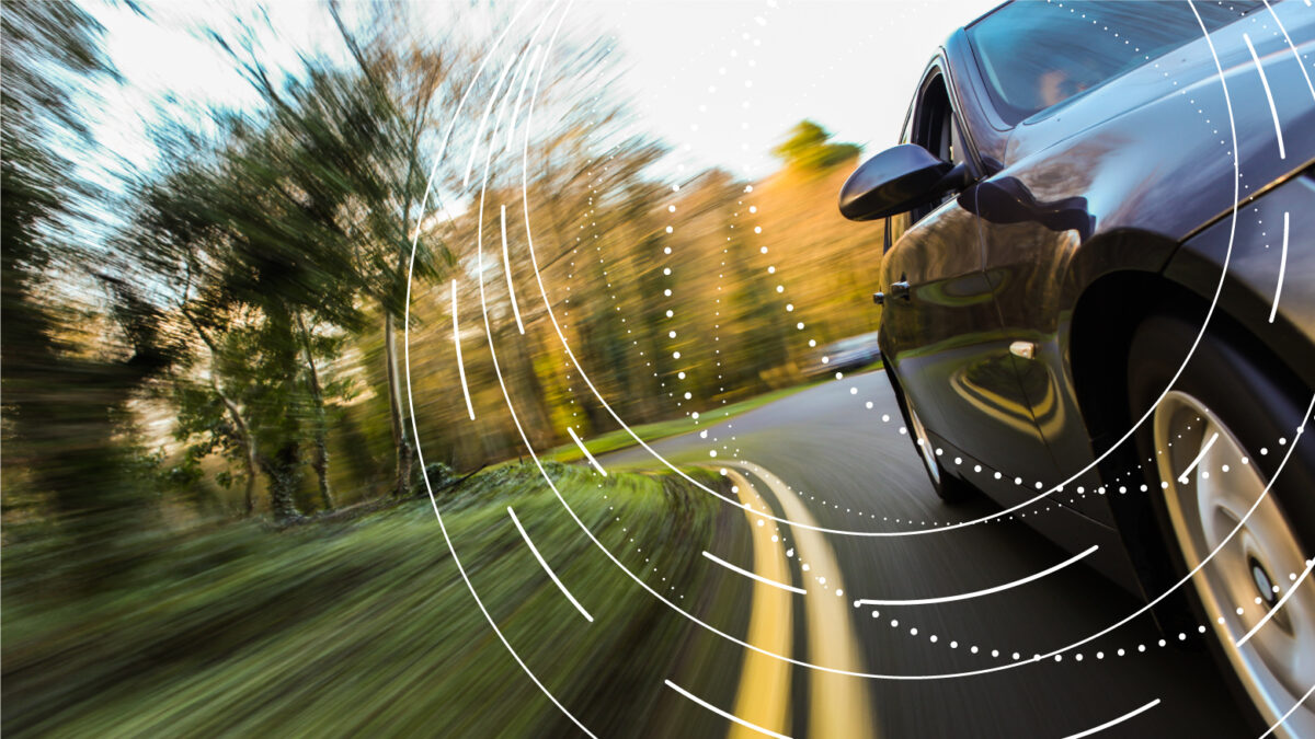
The Roadside Asset Data Service (RoADS) programme has seen 100 vehicles fitted with computer vision to carry out automated mapping, with the system trained to recognise objects and monitor their condition. It is like the technology used in many self-driving cars to visualise the road ahead. Since May 2019, the project has automated the mapping of nearly 2 million road-side features throughout Great Britain—primarily in the North-East of England—using vehicle-mounted cameras as well as other forms of sensor. This is combined with geospatial information from Ordnance Survey to create an unprecedented data service providing visibility of the roadside assets and infrastructure across the country.
The advantages of this initiative are substantial. As the camera and sensor technology is mounted on vehicles that form utility fleets, the extensive mapping takes place as part of the daily, business-as-usual journeys for the partnering organisations. This cross-sector collaboration itself makes the RoADS project unique. Ordnance Survey is working with Northumbrian Water Group to equip its fleets to carry out this mapping, and it has used the subsequent high-frequency mapping data to its target maintenance activity.
“Accurate and reliable mapping of things like manholes, fire hydrants and valves helps us to be more efficient in our maintenance and repair work by finding things quickly first time, every time,” said Clive Surman-Wells, who leads Innovation Partnerships at Northumbrian Water Group. “We’re looking at how we can improve and complete our asset records by cross-referencing data collected from vehicle-mounted image-recognition systems with Ordnance Survey mapping data and our own asset records.”
Connected cities
RoADS automated mapping may also facilitate the increased demand experienced worldwide for connections between vehicles and smart city infrastructure. The system can help to highlight collision hotspots and hazards in busy cities by monitoring the physical impact of road accidents. As well as opening the doors to EV roll-out, the project is paving the way for connected and autonomous vehicles. Through the programme the computer vision technology itself is being trialled and subsequently improved, which may have applications in future self-driving cars models. However, it is the high-frequency mapping and computer vision-based data capture which may prove the most valuable for autonomous vehicles, equipping the self-driving system with up-to-date information to enable safe navigation on roads.
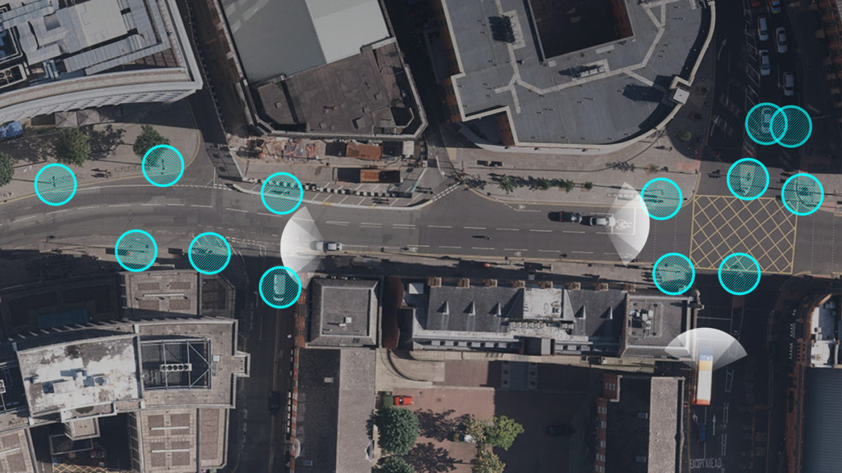
Cutting-edge car manufacturers such Tesla are already introducing road-sign recognition to their ‘autopilot’ systems. Damage to road signs must be identified and acted upon as quickly as possible or this may lead to a surge of incidents that result from incorrect speed limit detection. The Ordinance Survey’s system is already capable of recognising details of roadside assets, from manhole covers and street signs to the function of lampposts and condition of network cable boxes.
The way transport is used and the types of vehicles on roads are undergoing a revolution. It is essential that roadside infrastructure can keep up with the pace of innovation to support the transformative technologies—including EVs and autonomous vehicles—shaping the future of transport. However, it is also vital that transformation in the transport sector is compatible with the other essential networks such as electricity, water, and gas. Cross-industry, collaborative projects like RoADS are only the beginning for future approaches to infrastructure creation and maintenance that will have huge benefits for the stakeholders involved, and create a safer, greener, and more effective network.
About the author: Simon Navin is Head of High Definition Roads at Ordnance Survey