Close to a billion people rely on TomTom maps, says Charles Cautley, Managing Director of Maps at TomTom.

are required to support the evolution in
location awareness where everything is
becoming connected” – Charles Cautley
Cautley is responsible for TomTom’s map products that power an array of applications developed by its partners in automotive, mobile, Internet, location-based services and geospatial solutions. From this position, he can see first-hand the fast-moving world of consumer electronics, the growing use cases for location data, and the development of products needed to support these future use cases. The result is that TomTom is creating the mapmaking engine that supports connected cars, automated driving and, by extension, the Internet of Things (IoT).
Connected car
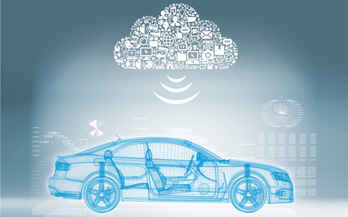
To a wide extent, the connected car has already been a reality for several years. TomTom sold its first connected portable navigation device (PND) in 2007, and installed the first connected built-in system, in a Renault vehicle, in 2009. Cautley explains that the primary benefit of having connected cars is “the possibility to deliver car-centric value-added real-time services.” TomTom Traffic, for example, provides real-time ‘jam’ information and avoidance, and today, with the development of 4G LTE networks, connectivity is becoming a commodity. This has increasingly enabled the development of advanced cloud-based services. Ultimately, he says, “consumers are hyper connected, they want to have a certain continuity in their digital life, and they expect their vehicles to be an extension of this digital life. We need to provide a seamless experience to them, but it is a formidable challenge for companies like TomTom.”
Consumers have become increasingly dependent on reliable access to Internet-based applications on the move, wherever they are. Because of this, the industry is working to ensure cars can stay connected, even in areas with poor reception.
Cautley explains that “connectivity enables great use cases, and in most cases the GSM coverage is excellent in a majority of the mature markets.” At TomTom, the company believes in a ‘hybrid approach’ to embedded navigation, where systems make the most of a data connection when available, but will also continue working when there is no GSM signal.
Smart maps lead the way
With the mass-commercialisation of 3G technology spreading to consumer devices, there has been an ever expanding need for people to remain connected wherever they are, with the car gaining increasing importance. The idea is simple: every step you take, every move you make, you’ll be connected. Mobile phones are no longer just a form of communication, and cars are no longer just a form of mobility, but more so a computer on wheels, or as some have even argued, a smartphone on wheels.
Part of the appeal of seamless connectivity is the ability to accurately navigate around the immediate environment. For the automotive industry, this extends further than satellite navigation, and for TomTom, new opportunities are presenting themselves as developments in the autonomous car and electrified powertrain increase.
“Highly accurate and up-to-date maps are required to support the evolution in location awareness where everything is becoming connected,” Cautley observes. “Connected cars are part of the IoT family and we have created the mapmaking engine that supports this evolution.” He predicts that real-time map updates will enable the connected car to know exactly where it is, what is around it and where it is going at all times. “The up-to-date, highly accurate map will also enable autonomous driving,” he adds.
To ensure maps have a high degree of accuracy, TomTom relies on ‘intelligent map-making’, and to support this, it has developed an efficient hybrid approach that combines professional map-making methods with community input, with a focus on fast cycle-times and quality assurance. Through this hybrid approach, TomTom taps into local teams of skilled map technicians located across more than 40 countries, and a fleet of mobile mapping vans that drive the streets every day.

Stay updated
With the growing dependence on in-car navigation systems, maps can no longer be out-of-date. Using mobile mapping vans alone to keep maps up-to-date is too slow, Cautley says, and using community input alone has risks. There are three main challenges, he explains. “First, we have to allow for fast cycle times from real-world changes through to the end-user experience via a closed-loop system. Second, we need to deliver this change with the high levels of quality assurance that consumers expect.” Finally, data use also plays a key part in keeping maps up-to-date. The processing of the sensor data used in the map needs to be efficient, the sending and receiving of data needs to be optimised, and the processing of large volumes of data from all the connected devices needs to be tuned “to maximise the value that can be extracted back to the devices.”
 “We also have a growing community of hundreds of millions of users that share map feedback with us as changes in the real world are detected. We receive more than 200,000 consumer reports monthly and our database of anonymous GPS measurements is at 12 trillion probe-data-points and growing,” Cautley explains.
TomTom makes hundreds of thousands of edits to its maps every single day, rapidly shortening the time between detecting changes in the real world and updating the map on an end-user’s device. “With this seamless process, we will always be the first to publish the most up-to-date and accurate maps in the market. Today our legacy navigable map products are released every three months. Going forward, we will release our maps much more frequently; monthly, weekly and eventually releasing updates in days – and for some map features – hours.”
What next?
With the prospect of self-driving cars and vehicle-to-everything (V2X) connectivity in the very near future, the demand for highly accurate maps will only increase further as the use cases for up-to-date maps increase. According to a new report carried out by Juniper Research, some 700 million
cars are expected to be on city roads around the world by 2019. Future ‘smart cities’ are set to reduce congestion through digital technology such as road sensors and software systems, and communications such as signage. In order for a vehicle to drive autonomously around these congested cities, and accurately interact with local traffic, buildings and consumer devices, it must have access to the most precise and up-to-date map data to help the car sense its environment and navigate without human input. TomTom aims to deliver this level of precision with its real-time maps.
Freddie Holmes